Lidar.png
2. Areal Imaging and LiDAR Sensors are Good For Plant Health Monitoring
Forests are dense and sometimes hard to traverse, making it difficult to track plant life. Especially when the weather is erratic, you expend double the energy and time checking on them. Not to mention, it’s also hazardous to do so, but such are occupational hazards.
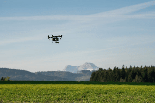
However, we now have drones that can lend a helping hand through this task. Specifically, LiDAR drones with artificial intelligence have been advantageous in monitoring plant health. The sensors can help gather and process data regarding the well-being of trees, vegetation, and bushlands.
Using thermal and areal imagery, and topographic surveillance, they can locate diseased flora. They can also lead horticulturists and forest officials to those locations. And with the collected data, they can begin applying the proper treatment needed.
3. Forest and Land Stewardship Strategies
Organizations that manage vast forests can use LiDAR drones to gather data for their strategies. They can monitor the land and send you updates regularly. Excellent drone photography or a 3D-rendered version of the forest will allow them to make accurate decisions.
LiDAR drones can also send data regarding the health of your land so you can act immediately. If you need a layout of your property, a drone can bring you the data needed for a 3D map. The data is so accurate you can even create comprehensive maps of the place.
And because the drone will be scouting the area, you’ll also know which spots are prone to landslides. Hence, you can avoid accidents and ecological disease based on gathered, accurate data.
4. Watch Out for Forest Fires
Forest fires are common occurrences and it’s nearly impossible to eradicate them. There are as many causes as they are menacing and devastating. All we can do is prevent them from happening as much as possible with the right data and action.
Because drones are fast and precise, they can scan areas of a vast forest for potential threats of fires. The LiDAR sensors should be able to pick up these sources so you can act. These precautions will help prevent fires from starting and uncontrollably razing the forest. The forest ecosystem, animals, and plants will be safe from the danger caused by forest fires.
5. Save the Lives of Forest Officials and Other People
Forests are dangerous places and accidents can happen anytime so drones are used to help with rescue missions. Especially with search missions, drones can save lives, more so with LiDAR sensors.
Imagine letting out the drone for the usual wildlife monitoring and biodiversity checking. And then, it picks up a human heat signature that isn’t in a good spot. If they just got in an accident, they won’t have to wait until someone asks about their whereabouts. It was a completely random time but the drone essentially saved someone.
Drones are also efficient in delivering emergency medication or surveying harmful activities. Flying them saves so much time than operating on food that they can very well save a life.
Source link
2022-10-18 21:33:01
Karl Hoffman is a distinguished agriculturalist with over four decades of experience in sustainable farming practices. He holds a Ph.D. in Agronomy from Cornell University and has made significant contributions as a professor at Iowa State University. Hoffman’s groundbreaking research on integrated pest management and soil health has revolutionized modern agriculture. As a respected farm journalist, his column “Field Notes with Karl Hoffman” and his blog “The Modern Farmer” provide insightful, practical advice to a global audience. Hoffman’s work with the USDA and the United Nations FAO has enhanced food security worldwide. His awards include the USDA’s Distinguished Service Award and the World Food Prize, reflecting his profound impact on agriculture and sustainability.
