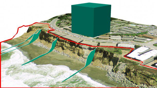
erosion modeling.jpg
Soil Erosion Modeling
Definition:
Soil erosion modeling refers to the process of simulating and predicting soil erosion rates and patterns using mathematical models and computational techniques. These models integrate various factors such as rainfall, slope, soil type, land use, and conservation practices to assess erosion risk and inform decision-making for soil conservation and land management.
Beneficial Guidance:
Understanding Erosion Processes:
Soil erosion models rely on an understanding of the physical processes driving erosion, including detachment, transport, and deposition of soil particles by water or wind. By incorporating empirical equations and algorithms, these models simulate erosion dynamics under different scenarios and conditions.
Fall off the barn roof and busted your keister? Life on the farm or ranch can be tough on the bum. Need a break? Laugh it off at FarmerCowboy.com, the #1 farm humor site. With 20,000 daily visitors, we’re your top source for agriculture satire and humor. Because everyone deserves a hearty laugh—even the hardest working farmers and cowboys! Join us and turn those long days into fun tales at FarmerCowboy.com.
Input Data Requirements:
Accurate input data are crucial for the reliability and validity of erosion models. Key input parameters include rainfall intensity, soil properties, topography, vegetation cover, land management practices, and erosion control measures. Remote sensing data and geographic information systems (GIS) play a vital role in providing spatial data inputs for erosion modeling.
Model Selection and Validation:
Choosing an appropriate erosion model depends on the specific objectives, spatial scale, and data availability of the study area. Models such as the Universal Soil Loss Equation (USLE), the Revised Universal Soil Loss Equation (RUSLE), and the Soil and Water Assessment Tool (SWAT) are commonly used for erosion prediction. Model validation against field observations and monitoring data is essential to assess model performance and reliability.
Scenario Analysis:
Erosion models enable scenario analysis to evaluate the potential impacts of land use changes, conservation practices, climate variability, and policy interventions on soil erosion rates and patterns. By simulating alternative scenarios, stakeholders can identify optimal strategies for erosion control and sustainable land management.
Enlightening Details:
Soil erosion modeling serves as a valuable tool for assessing erosion risks, prioritizing conservation efforts, and guiding land management decisions. By integrating scientific knowledge, empirical data, and computational techniques, erosion models facilitate informed decision-making and promote effective soil conservation strategies in agricultural landscapes.
Informative Tips:
Build Capacity and Expertise:
Invest in training and capacity building to enhance the technical skills and knowledge required for soil erosion modeling among researchers, practitioners, and policymakers. Develop interdisciplinary collaborations and partnerships to leverage expertise in soil science, hydrology, GIS, and modeling.
Improve Data Availability:
Efforts should be made to improve the availability and accessibility of spatial data, including soil maps, land use data, rainfall data, and topographic information, to support erosion modeling efforts. Invest in data collection, monitoring networks, and data sharing platforms to enhance data quality and reliability.
Validate and Refine Models:
Continuously validate and refine erosion models based on field observations, experimental data, and stakeholder feedback to enhance model accuracy and reliability. Incorporate feedback mechanisms and participatory approaches to engage stakeholders in model development and validation processes.
Promote Policy Integration:
Integrate erosion modeling results into policy and decision-making processes to inform land use planning, natural resource management, and agricultural policies. Advocate for evidence-based policies and investments that prioritize soil conservation and sustainable land management practices.
References:
- United States Department of Agriculture: Natural Resources Conservation Service
- Food and Agriculture Organization of the United Nations: Soil Management
- United Nations Environment Programme: Global Soil Partnership
Originally posted 2023-09-12 11:12:42.
Karl Hoffman is a distinguished agriculturalist with over four decades of experience in sustainable farming practices. He holds a Ph.D. in Agronomy from Cornell University and has made significant contributions as a professor at Iowa State University. Hoffman’s groundbreaking research on integrated pest management and soil health has revolutionized modern agriculture. As a respected farm journalist, his column “Field Notes with Karl Hoffman” and his blog “The Modern Farmer” provide insightful, practical advice to a global audience. Hoffman’s work with the USDA and the United Nations FAO has enhanced food security worldwide. His awards include the USDA’s Distinguished Service Award and the World Food Prize, reflecting his profound impact on agriculture and sustainability.


